We have completed a Stormwater Flood Study for Anglesea and Aireys Inlet. It provides a deeper understanding of the local stormwater network and flood risks. This will help us better protect our community by:
- identifying stormwater issues,
- planning infrastructure upgrades, and
- exploring mitigation options.
Why Anglesea and Aireys Inlet?
These townships have a history of stormwater challenges, including:
- Flooding of properties on the drainage line between the Anglesea Golf Course and its outlet at the Anglesea River in January 2022 due to a severe storm.
- Flooding of properties in Aireys Inlet, also in January 2022.
- A low number of stormwater quality improvement assets, which is typical of older townships.
What did the study find?
Using rainfall data from the January 2022 storm and a range of rainfall (from 30 minutes to 12 hours), flood hazard modelling was completed in focus areas requested by Council.
This was based on a 1% Annual Exceedance Probability (AEP) event (a flood with a 1-in-100 chance of occurring in any given year).
While the mapping doesn’t predict exact outcomes during future storms, it highlights areas more or less prone to flooding. This allows Council to plan ahead rather than react after the fact.
What happens next?
- The flood mapping is for information only and will not result in changes to the Surf Coast Planning Scheme, such as inundation overlays.
- The study supports better decision-making for development and emergency response.
- It will help Council pursue funding for mitigation options like network upgrades, emergency service coordination, and building advice for residents.
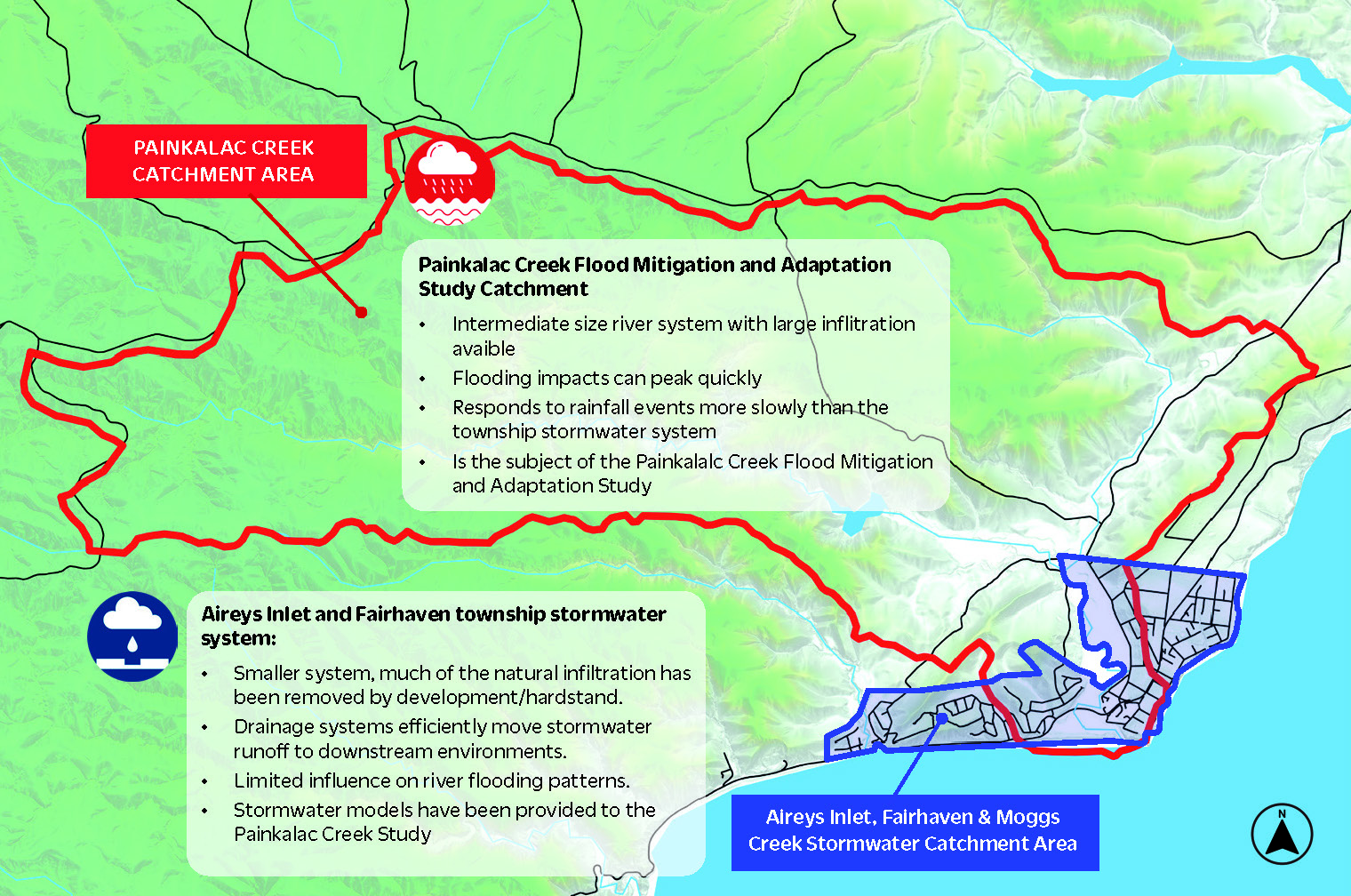
- It will contribute to broader flood risk projects, including the Painkalac Creek Adaptation and Mitigation Study and the upcoming Anglesea River Flood Study.
Looking ahead
Council is committed to improving stormwater quality and exploring reuse opportunities.
Extreme weather events are becoming more frequent. Council has a responsibility to plan for climate change risks, which includes exploring how we can invest in assets so that they can withstand severe weather events in the future.
More township modelling is planned across the shire to continue building a safer, more resilient Surf Coast.
A closer look at the catchment area: